"Flood affected" on a planning certificate covers two completely different conditions, and councils write them in almost identical language. One of them costs you a floor level. The other quietly removes you from the mid-rise housing reforms in twenty-two council areas. Owners are routinely told they have the first when they have the second.
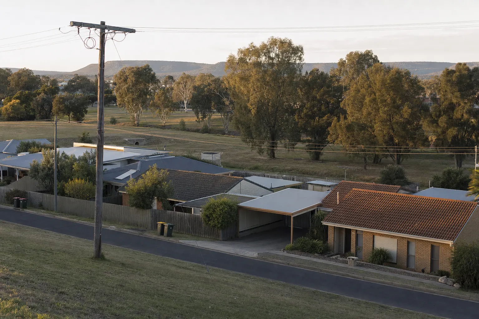
Two houses, four doors apart, on a street that runs gently downhill toward a creek line most people would call a drain. Both R3. Both inside the walking catchment. Same era, same brick and tile, near enough the same land area.
One of them can carry a mid-rise residential flat building. The other can't, and the reason has nothing to do with the zone, the frontage, the neighbours or the heritage overlay. It's that the lower one sits inside the flood planning area and the upper one doesn't, and in that council's local government area the flood planning area is an exclusion from the state housing policy.
The owner of the lower house had been told by two separate agents that her block was "the same as everyone else's down here". She'd had a number in her head for about eighteen months. It was not the right number, and nobody had lied to her — they'd just read the word "flood" on a certificate and assumed it meant what it means in ordinary speech, which is that the place gets wet sometimes.
Flooding is the constraint I find owners most confidently wrong about, and it's because the vocabulary is genuinely awful.
Three terms that sound like the same term
Flood prone land is the outer envelope. Under the NSW Flood Risk Management Manual, gazetted in 2023, flood prone land is land susceptible to flooding up to and including the probable maximum flood. The PMF is not a realistic planning event. It's the theoretical upper bound, the biggest flood that could conceivably occur, and in a valley like the Hawkesbury-Nepean it covers ground that has never been wet in recorded history and never will be in most of our lifetimes. A great deal of ordinary suburban Sydney is flood prone land in this sense. It tells you almost nothing on its own.
The flood planning area is the working line, and it's much tighter. It's derived from the flood planning level, and the manual's position is that a defined flood event of 1% AEP — the flood with a one per cent chance of being equalled or exceeded in any year, which people still call the one-in-a-hundred — plus a freeboard should generally be the minimum basis for setting residential flood planning levels. Councils can adopt a different event or a different freeboard, but they have to justify it through the flood risk management process. Inside the flood planning area you get real controls: minimum floor levels, flood-compatible materials, restrictions on what can go at ground level, sometimes evacuation requirements.
Between the flood planning area and the PMF is the third zone, and it's the one nobody explains. You are above the working flood line but still on flood prone land. Standard Instrument clause 5.22, Special Flood Considerations, is the LEP provision that reaches into this band — and it's an optional clause, so whether it applies to you at all depends on whether your council adopted it. Where it does apply it targets sensitive and hazardous development and land presenting a particular risk to life, mostly through evacuation.
Clause 5.21, Flood Planning, is the compulsory one and it governs the flood planning area proper.
So: two clauses, one mandatory and one optional, covering two different bands of the same floodplain, described in conversation by the same word.
What your certificate is actually telling you
The planning certificate has to answer this in two separate parts, and the difference between them is the whole ballgame.
Schedule 2 of the Environmental Planning and Assessment Regulation 2021 requires the council to state, first, whether the land or part of it is within the flood planning area and subject to flood-related development controls. Second, and separately, whether the land or part of it is between the flood planning area and the probable maximum flood and subject to flood-related development controls.
Read those two entries against each other rather than scanning for a "yes". A yes on the first means floor levels and build cost. A yes on the second only means you're in the outer band, which on its own may change very little — or may matter enormously, depending on your council and what you want to build.
Councils are also permitted to answer "unknown" where they don't hold the information, and plenty do. An unknown is not a no. It usually means the flood study for your catchment hasn't been done or hasn't been adopted yet, and it means a purchaser or a developer will price the uncertainty rather than ignore it.
One more: councils should note on the certificate if a flood study or floodplain risk management study is under way. A study in progress is a material fact about your land, in the same way a draft LEP amendment is, and it's easy to skim past.
The bit that decides development value
Here's where the abstraction turns into money.
The Low and Mid Rise Housing Policy — the reform that made dual occupancies, terraces, multi dwelling housing and mid-rise apartment buildings possible on land that previously couldn't carry them — carries a list of excluded land. Flooding appears on that list three separate times, in three different formulations.
The Hawkesbury-Nepean probable maximum flood is excluded. The Georges River catchment probable maximum flood is excluded in specified council areas. And the flood planning area is excluded in twenty-two named local government areas.
Those are not the same test and they don't catch the same blocks. In the Hawkesbury-Nepean, the exclusion runs all the way out to the PMF, which is the outer envelope described above and takes in a very large amount of land that would never be described as flood affected in ordinary conversation. In the twenty-two LGAs, the exclusion is the tighter flood planning area line — so being on flood prone land above the flood planning area leaves the reforms available to you.
That asymmetry is why the two houses in the street get different answers, and it's why a general statement like "we're a flood area around here" is worthless. The question is never whether your suburb floods. It's which line your parcel sits on, in which council area, against which of the three exclusions.
It pairs with the heritage conservation area situation as the other half of the same lesson: the exclusions are drafted narrowly and precisely, and the local folklore about them is drafted neither.
Complying development, and why the fast pathway disappears
A flood control lot is a lot to which flood-related development controls apply. Various state policies restrict what can be done as complying development on one, which in practice means the fast complying development pathway narrows or closes and you're into a full development application with the assessment period that implies.
That's a programme cost and a holding cost rather than a prohibition, but on a small infill project the difference between weeks and many months is often the difference between the project working and not.
The framework is mid-reform, and that's worth knowing
I'd normally skip the policy weather in a piece like this, but this one affects how much weight to put on anything you're told.
The department's flood guidance to councils was consolidated into a single planning circular, PS 26-001, issued on 13 February 2026, which combined the 2021 circular on considering flooding in land use planning and the 2024 update on flood risk in planning decisions. That circular now carries an archived banner and doesn't appear on the department's list of current circulars, and no flooding circular has replaced it.
What's happening in the background is a proposed Climate Change and Natural Hazards State Environmental Planning Policy, which the department exhibited between 17 February and 16 March 2026. Where that lands will change how flood risk is weighed in development assessment across the state.
The practical read: the underlying instruments — clause 5.21, clause 5.22, the certificate requirements, section 4.15 of the EP&A Act, the Ministerial Direction on flooding for rezonings — are all still in force and still operate exactly as described above. What's unsettled is the guidance layer sitting on top, and the direction of travel since the 2022 NSW Flood Inquiry has been consistently toward more scrutiny of evacuation and risk to life, not less. If you're relying on an assessment done a few years ago, or on what a neighbour got approved in 2019, discount it. The department's flooding page is where the current state of play gets published.
What actually moves the number
Three things, in the order they matter.
Which line you're on. Not your suburb, not your street, your parcel — and specifically whether it's inside the flood planning area, between the flood planning area and the PMF, or outside flood prone land entirely. The council's adopted flood study is where this lives.
Whether your council is one of the excluded LGAs, and under which of the three flood exclusions. This is a yes or no question with a public answer, and it's the single largest swing in what a developer will pay for your land on any block within cooee of a creek.
Evacuation, which is the newest and least understood of the three. Post-inquiry, the questions the department wants planning authorities asking are about whether people can get out — warning time, rate of rise, when the evacuation route is cut, and whether a proposal adds to the risk to life elsewhere in the catchment during an extreme event. On a site with a single road out through a low point, that consideration can constrain a scheme that the floor levels alone would have allowed. It's also the reason a small increase in dwelling count is scrutinised more heavily now than it was five years ago.
Before you accept the flood answer you've been given
Get the council's adopted flood study and find your lot on the map, rather than reading the certificate's yes or no. The study will show you the 1% AEP extent, the PMF extent, and usually the hazard categories — floodway, flood storage, flood fringe — which are what really determine whether anything can be built at ground level.
Order the 10.7(2) and read entries one and two of the flood section separately. If either says "unknown", ring the council and ask whether a flood study is under way and when it's due.
Then check your council against the exclusion lists before you let anyone quote you a mid-rise yield. On a site being assembled with neighbours this matters twice over, because one flood-excluded lot in the middle of an assembly can take the whole scheme down.
PropertyThrive does this check as part of a free development assessment — the flood layers, the exclusion lists, and a straight answer about which of the three bands your parcel is in. Book an assessment and you'll have it back within 24 hours.
Ready to get started with developing a property?
Get your development assessment or speak with our development experts today
24-Hour Response Guarantee
Submit your details and receive your preliminary development assessment within 24 hours, guaranteed.
No Obligation, Completely Free
Our assessment and initial consultation are completely free with no strings attached. Only proceed if you're 100% happy.
Strategic Development Partnerships
Partner with us to maximise development potential through joint ventures, profit-sharing, or direct acquisition options.