Integrated Development, Concurrence and Referrals: When the Council Isn't the Only One Deciding
A development application can pull in another agency three different ways, and the three carry very different weight. A referral produces advice your council can disagree with. A concurrence has to be given or the council must refuse you. Integrated development means a second Act's approval is embedded in your DA. The one that catches Illawarra owners most often is a mapped watercourse and the 40 metres of waterfront land that comes with it.
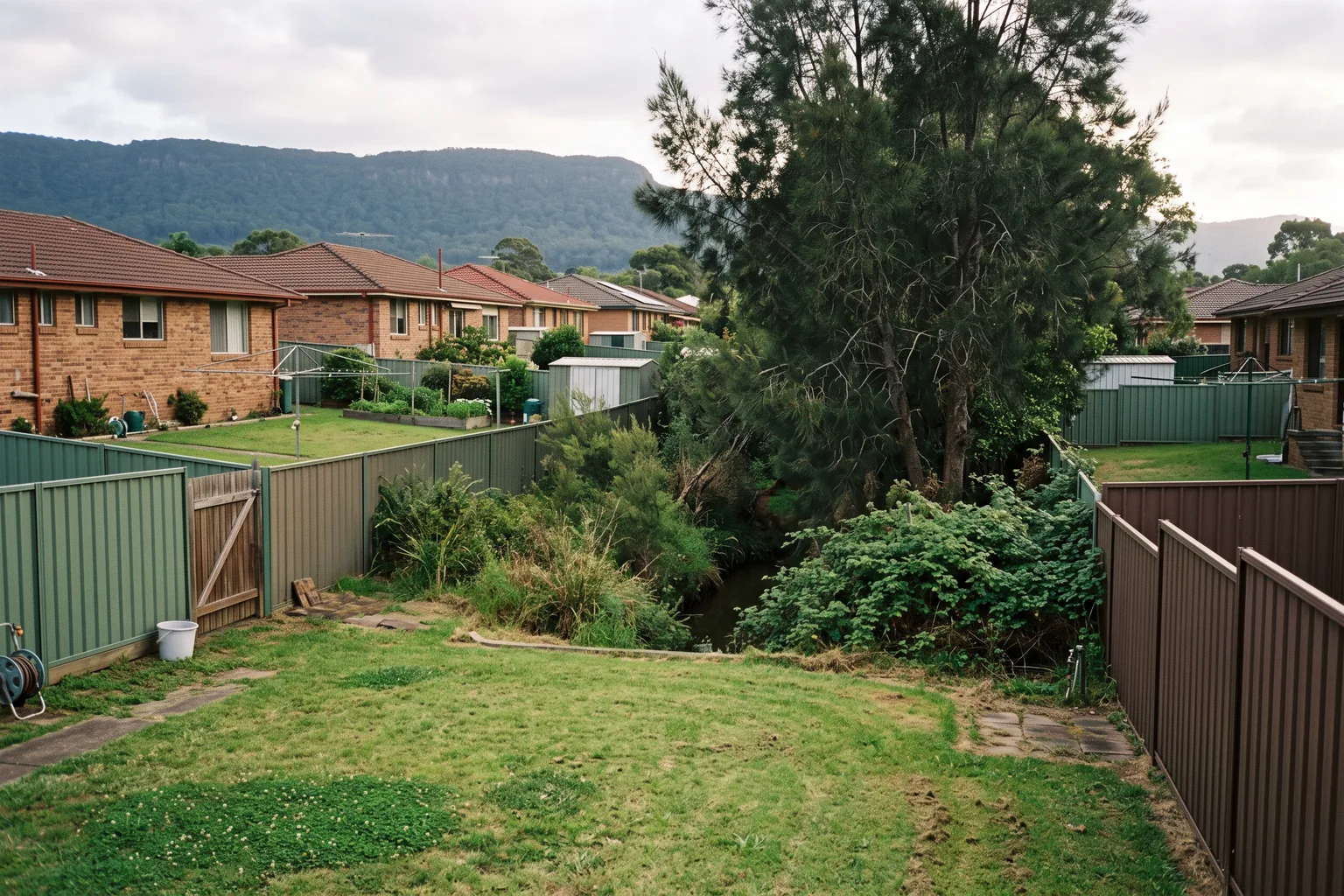
The block had a drain along the back fence. That is what the owner called it, that is what it looked like, and on the aerial it is a line of blackberry and a bit of casuarina running behind six properties before it disappears under a road.
He wanted a detached dual occupancy with the second dwelling toward the rear. Reasonable block for it, 1,050 square metres, good fall, nothing on the 10.7 certificate that worried him.
Then his planner opened the hydro line layer and the drain was a mapped watercourse. Which meant the bed of it plus everything within 40 metres of the bank was waterfront land, which covered the entire rear third of his block, which meant the dwelling he wanted to build there was a controlled activity, which meant his development application was integrated development under the Water Management Act and the council could not approve it without another agency's sign-off.
None of that was on the certificate. None of it was visible from the street. And the difference between finding it at concept stage and finding it after lodgement was about five months.
Advice, agreement, and a second approval
The department's Development referrals guide runs to 196 pages, almost all of it trigger tables. The part that changes how you behave sits in the first three pages, and it is the distinction between three things that look identical from where you are standing.
A referral for consultation is a request for advice. The council must refer certain applications where the legislation requires it, usually a clause in an environmental planning instrument, and the referral authority writes back with a view that the council has to consider. Consider, not obey. The guide's illustration is section 2.122 in Chapter 2 of the Transport and Infrastructure SEPP, which makes councils consult Transport for NSW on traffic-generating development on certain land.
A concurrence is agreement. The guide is blunt about it: concurrence is when agreement from a referral authority must be obtained before the council can determine the application. Those requirements usually sit in an environmental planning instrument, though some live directly in Acts, the Biodiversity Conservation Act 2016 among them. And if a referral authority refuses to give concurrence, the council must refuse the DA.
Integrated development is heavier again. It applies where a development needs approval under the EP&A Act and under another NSW Act listed in section 4.46. Heritage is the department's own example: work on a building listed on the State Heritage Register needs consent under the EP&A Act and an approval under section 58 of the Heritage Act 1977. Instead of running the two processes end to end, the DA carries both. The council refers the application and asks the other agency for its general terms of approval, an in-principle approval setting out the terms and conditions that, if met, will get you the second approval later.
Same hard edge. Refuse the general terms and the council must refuse the DA. Grant them and the consent the council issues has to be consistent with them, after which you go and apply for the actual second approval.
Advice you can argue with. Agreement you cannot proceed without. A second statutory approval embedded inside the first. On the Planning Portal, all three appear as a line saying a referral has been made.
What waterfront land actually means
Back to the drain, because this is the trigger that catches more Illawarra and southern Sydney blocks than anything except bush fire.
Under section 91(2) of the Water Management Act 2000, a controlled activity on waterfront land is integrated development, with DCCEEW's Water Group as the referral authority. Two definitions do all the work.
Waterfront land means the bed of any river, lake or estuary, and the land within 40 metres of the riverbank, lake shore, or estuary mean high water mark. Forty metres is a long way on a suburban block. On a standard 15 by 40 metre lot backing a creek line, waterfront land is most of the lot.
A controlled activity is a defined list, and it is broader than people expect. Erecting a building. Carrying out a work, which takes in bridges, roads, control measures and sea walls. Removing material from waterfront land, including plants, rocks, sand and gravel. Depositing material, including gravel or fill. Any activity that affects the quantity or flow of water in a water source. So it is not only a dwelling. Cut and fill on a sloping rear yard is a controlled activity. So is clearing the vegetation along the bank before you start.
There is a Waterfront land e-tool for checking the definition against an address, and the mapping itself comes from the hydro line layer. Which brings us to the escape hatch.
Proving there is no river
The guide admits something useful, and it is the reason the drain story does not end where it started. The hydro line layer, it says, is not always accurate in identifying the true on-ground location of rivers.
More than that: where a mapped watercourse does not exhibit the features of a defined channel with bed and banks, or sufficient riverine features, the Water Group may determine that the watercourse is not waterfront land for the purposes of the Act, and no controlled activity approval is required.
That is a real determination, not a favour, and the guide sets out what to lodge to get it. A map or aerial photograph of the property showing where the mapped watercourses are. Photographs of the mapped watercourse area upstream and downstream of the subject property. And the photo locations and directions clearly marked on that map. Three documents, and they are the difference between an integrated DA and an ordinary one.
Worth noting what the determination does not do. Any mapped watercourse found not to be waterfront land does not change the Strahler stream ordering of other mapped watercourses on your land or on your neighbours'. Stream order comes from the hydro line layer and nothing else. You are getting yourself out, not redrawing the map.
There are also exemptions from needing an approval at all, set out in sections 40 to 43 and Schedule 4 of the Water Management (General) Regulation 2018. I am deliberately not summarising those, because exemption lists are the thing people paraphrase wrongly and then rely on.
And if you are staying in the regime rather than arguing your way out of it, the statement of environmental effects needs a riparian and waterfront land section addressing compliance with the Guidelines for controlled activity approvals, with justification for any non-compliance, plus something most consultants forget: consideration of any conflict between those guidelines and bush fire asset protection or flood study requirements.
Sit with that last clause for a second. The state's own guidance anticipates that the riparian setback, the asset protection zone and the flood planning level will want different things from the same strip of ground, and it puts the job of reconciling them on you. If your block carries two of those layers, the design problem is not each constraint separately. It is the overlap, and the overlap is where yield disappears. Our pieces on BAL ratings and bush fire prone land and on flood prone land each cover one of those layers on its own.
The clock, and what silence buys you
Here is the part that should change what you do while you wait.
If a referral authority does not respond to a request for concurrence or a referral by the time the statutory period lapses, where a period applies, the council may determine the DA without the concurrence or without considering the comments. That is a genuine release valve. It is also why "the council is sitting on it" is sometimes the wrong diagnosis and sometimes exactly the right one.
The periods are set agency by agency rather than in one table, which is the awkward part. Some examples from the guide: Fisheries assesses and provides general terms of approval within 40 days. For more complex applications in the Sydney drinking water catchment, WaterNSW completes its concurrence assessment within 40 days. Applications referred to Subsidence Advisory under Division 4.8 of the EP&A Act are processed within 21 days.
In nearly every one of those, the clock stops while the agency waits for information it has asked for. So an incomplete referral package is not a week's delay. It is however long it takes someone to notice the request.
Two more things about concurrence specifically. There is no obligation on an authority to respond to a concurrence request. And an authority may decline to give concurrence on the basis that the application has not given it enough to decide on, which is not the same as a refusal but lands in a similar place.
Integrated development does not work like that at all. General terms of approval are not something a council can proceed without, so a slow agency on an integrated file is a dead stop rather than a clock you can outlast. There is a backstop in the Planning Secretary's functions, available where a referral authority has missed statutory timeframes or where two authorities issue general terms that conflict so badly that complying with one would breach the other. The guide says those functions are used sparingly. Treat them as something that exists, not something to plan around.
This is also why a deemed refusal appeal is a poor instinct on an integrated file. You do not improve your position by taking a matter to the court while the approval the council is legally required to wait for is still outstanding.
Everything runs through the Portal now
Since section 286 of the Environmental Planning and Assessment Regulation 2021, consultation referrals, concurrences and integrated development approvals all have to be lodged and processed through the NSW Planning Portal. The council lodges the request, the authority responds there, and fees and tracking sit in the same place.
Which removes an excuse rather than solving a problem. The information is not hidden. What owners lack is the question, and the question is one sentence: which authority, which trigger, and is it a referral, a concurrence or integrated development.
The direction is fewer referrals, slowly
The state has been cutting this back rather than adding to it. A package of concurrence and referral changes went through 16 state environmental planning policies and 16 local environmental plans, replacing some requirements with alternatives meant to achieve equal or better outcomes and refining others so they only bite where a case-by-case review is genuinely needed. Those commenced on 26 November 2021 under the SEPP Amendment (Miscellaneous) 2021.
More recently, Transport Oriented Development Accelerated Precincts received a three-year exemption from certain concurrence and referral provisions judged not to be high-risk, effective 27 November 2024. A site inside one of those precincts is not on the same assessment path as an identical site three streets outside it, which is one more thing to hold alongside what a TOD rezoning does to a block.
What is not being cut is the high-risk end. Bush fire, heritage, water. Those are exactly the ones being kept, and they are the ones most likely to be sitting on a residential block.
Do the mapping before the design
Work the triggers off the mapping rather than off the design, because the design cannot tell you anything the mapping hasn't already decided. The hydro line layer and the waterfront land tool. Bush fire prone land. Heritage, both the State Heritage Register and any local listing or conservation area. Rail corridors, classified roads, the drinking water catchment, mine subsidence districts. That is an afternoon with the 10.7 certificate and the Portal's spatial layers.
If a trigger is live, book a pre-lodgement meeting with the referral authority, not just with the council. The department's own position is that proposals relying on complex performance-based solutions may benefit from meeting the relevant authority before lodgement, and that doing so can save the applicant time and money by discussing the issues first. Almost nobody does it.
And when the file goes quiet, ask a specific question instead of a general one. Not where is it up to. Which authority, which trigger, which of the three mechanisms, and has the statutory period started. Those four answers tell you whether to wait, whether to chase, or whether the scheme in front of the agency was never going to be approved in the form you sent it.
The owner with the drain got his determination, as it happens. Photographs upstream and downstream, no defined bed and banks worth the name, not waterfront land, ordinary local DA. It took about six weeks and cost him a consultant's day. Had he lodged first and found out afterwards, it would have cost him the assessment clock as well.
PropertyThrive checks the referral triggers on a block before any design work, because a scheme that has to pass another agency is a different scheme from one that doesn't. If you'd like that run on your property, ask for an assessment and we'll come back to you within 24 hours.
Ready to get started with developing a property?
Get your development assessment or speak with our development experts today
24-Hour Response Guarantee
Submit your details and receive your preliminary development assessment within 24 hours, guaranteed.
No Obligation, Completely Free
Our assessment and initial consultation are completely free with no strings attached. Only proceed if you're 100% happy.
Strategic Development Partnerships
Partner with us to maximise development potential through joint ventures, profit-sharing, or direct acquisition options.