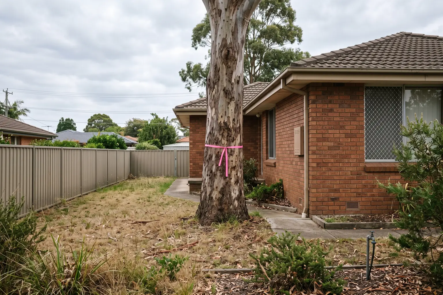
Tree removal on an urban block is governed by three different instruments depending on why you're removing the tree, and owners routinely use the wrong one. Chapter 2 of the Biodiversity and Conservation SEPP, the council's DCP, the Biodiversity Offsets Scheme threshold and the RFS 10/50 code each answer a different question. A worked example on an R2 block in Figtree shows which applies when.
An owner in Figtree rang in June with what he described as a simple question. He had three spotted gums along the northern boundary of a 720 square metre R2 block, he wanted to put a second dwelling where they stood, and a bloke at a barbecue had told him the 10/50 rule meant he could take them out this weekend and lodge the DA on a clean site.
I asked him to send me his 10.7 certificate before he hired anything with a chainsaw. Two of the three trees were probably removable under that rule, as it turned out. The third was not, the site wasn't cleanly inside the entitlement area, and if he'd cleared all three and then lodged, the assessing planner would have opened the aerial imagery from the previous year and seen exactly what he'd done. That is not a good opening position for a DA.
This is the question underneath his question, and it's the one nobody at the barbecue asks: why are you removing the tree? The answer decides which instrument governs it, and there are at least three.
Where the tree controls actually live now
Older owners, and quite a few older planning consultants, still talk about "clause 5.9". That was the Standard Instrument clause every Local Environmental Plan carried, headed Preservation of trees or vegetation, and it's the clause the old tree permit sat under. It's gone. The department's own page on vegetation in non-rural areas refers to it as "the former clause 5.9 of the relevant local environmental plan", which is the department's way of telling you not to look for it.
What replaced it was a State policy. The Vegetation in Non-Rural Areas SEPP came in during 2017, and on 1 March 2022 it was folded into Chapter 2 of the State Environmental Planning Policy (Biodiversity and Conservation) 2021, which the department says "replicated the 2017 policy". Chapter 2 is the instrument for clearing on land zoned for urban and environmental purposes, and the important qualifier is right there in the department's first sentence: it sets the rules for clearing "that is not linked to a development application".
Read that twice, because it splits the topic in half.
If the tree is coming out as part of a development you're seeking consent for, the tree is assessed inside the DA. It's one of the matters the consent authority weighs under section 4.15 of the Act alongside everything else, and the council's development control plan tells you how it will be weighed. You don't apply for a separate permit. You show the tree on the site plan, you attach an arborist's report, and you argue for the removal as part of the scheme.
If the tree is coming out on its own, with no DA behind it, Chapter 2 applies, and Chapter 2 has four parts.
The four parts, and which one an owner meets
Part 2.2 is the general rulebook. It sorts clearing into activities that need a permit, activities that don't, and activities permitted without development consent at all. I'm not going to list the exemptions here, because they are precisely the kind of thing that gets paraphrased wrongly and then relied on, and the answer for a specific tree on a specific block is a ten-minute check against the current text of the instrument rather than a blog post.
Part 2.3 is the council permit. Here's the mechanism, and it matters: the SEPP doesn't itself say which trees need a permit. It lets each council declare, in its development control plan, the vegetation to which Part 2.3 applies. The department's page says a DCP "may identify the vegetation in any manner including by listing the species, size or location of vegetation, or the presence of vegetation in an ecological community or in the habitat of a threatened species". So one council's permit threshold is a trunk circumference, another's is a height, another's is a species list with exemptions for anything on a weed schedule, and the only way to know yours is to open your council's DCP tree chapter. Wollongong has one. So does every other coastal council I work in. They do not agree with each other.
There's a wrinkle in Part 2.3 worth knowing if you're relying on an older DCP. When the 2017 SEPP was introduced it carried a savings provision that picked up any vegetation a DCP had declared under the old clause 5.9. That provision was removed in December 2021, which quietly disconnected some DCPs from the permit system, and on 3 October 2022 the SEPP was amended so that Part 2.3 again applies to vegetation declared under the current chapter, under Part 3 of the former Vegetation SEPP, or under the former clause 5.9. In other words, the fix restored the old declarations. If your council's DCP still reads as though clause 5.9 exists, the permit requirement in it still bites.
Part 2.4 is the Native Vegetation Panel, and it applies when clearing exceeds the Biodiversity Offsets Scheme threshold. The department restates the area thresholds on the same page: 0.25 hectares on land with a minimum lot size under 1 hectare, 0.5 hectares where the minimum lot size is between 1 and 40 hectares. Above the threshold the panel, not the council, approves the clearing, and it's assessed under the Biodiversity Assessment Method, which means a BDAR and credits. I've written about what that scheme costs and how it's triggered separately. For three trees on a house block the area threshold is irrelevant. The Biodiversity Values Map is not, because mapped land is in the scheme regardless of area, and that check takes thirty seconds.
Part 2.5 is routine agricultural clearing on primary production land in the C and R5 zones. If you're reading a property development site you almost certainly don't meet it.
The 10/50 rule is a bush fire entitlement, not a clearing tool
Now the barbecue advice.
The 10/50 Vegetation Clearing Scheme sits under the Rural Fires Act, not the planning legislation, and the RFS administers it. The RFS describes it plainly: in a designated entitlement area it lets a person "clear trees on their property within 10 metres of a home, without seeking approval", and clear underlying vegetation such as shrubs, but not trees, within 50 metres. Note the anchor. It's measured from a home, meaning an existing dwelling, and the RFS clarified in 2015 that a tree qualifies only if "any part of the trunk that measures more than 30 centimetres in circumference (around the trunk) at a height of 1.3 metres above the ground, is within 10 metres of the external wall of the building". The same 2015 change brought multi-stemmed trees inside the definition of a tree, so they can no longer be taken beyond the 10 metres as if they were shrubs.
Three things follow, and my Figtree caller had missed all of them.
The entitlement area is not the same as bush fire prone land. Being on the council's bush fire prone land map, which I've covered in the BAL rating post, does not mean you're in a 10/50 entitlement area. You check that on the RFS's 10/50 online tool, and the RFS is specific that you check it "on the day you are clearing", keep the printout, and follow the rules in force that day, because the entitlement area and the excluded matters change.
The 10 metres runs from the wall of the house you have, not the house you're planning. A tree twelve metres from the existing dwelling that would sit under the footprint of the proposed second dwelling is outside the entitlement. That was the third spotted gum.
And the scheme exists to reduce bush fire risk to an existing home. Nothing in it prevents an owner who is genuinely entitled from using it, but a planner assessing your DA six months later is entitled to read the site history, and a scheme that arrives with a freshly cleared building envelope where the aerial shows canopy last year invites questions about whether the clearing was for protection or for yield. The scheme has already been reviewed once, with thirty recommendations, and the 2015 changes tightened the definitions for exactly this reason. I'd rather my clients never have to answer that question.
The Figtree block, worked through
Here is how the three instruments sorted his three trees, with the identifying details changed as usual. R2 Low Density Residential, 720 square metres, roughly 18 metres of frontage, single-storey brick house from the seventies set well forward on the lot, three spotted gums along the northern side boundary at roughly 6, 11 and 19 metres from the house's side wall. Bush fire prone land, as it happens, because the block backs onto the escarpment foothills. Not on the Biodiversity Values Map, which I checked first because it's the one that can't be designed around.
Tree one, six metres from the wall, trunk comfortably over 30 centimetres at 1.3 metres, and the tool put the block inside the entitlement area on the day we ran it. Removable under 10/50 without approval, subject to the excluded matters coming up clean. Tree two, at eleven metres, sat just outside. Tree three, at nineteen metres, nowhere near it.
So the real question for trees two and three was whether he was lodging a DA. He was, for a detached dual occupancy at the rear, and the trees stood inside the proposed footprint. That put them inside the DA. What Wollongong's DCP does with a tree of that size on a development site is a matter for the arborist's report and the assessment, and the honest position is that a mature native on a boundary in a low-density zone is not a tree a council likes to lose. The arborist's report gave it a fair retention value and a poor prognosis under the proposed excavation for the slab, which is the usual argument, and the scheme was designed with a tree protection zone around tree one, which we kept even though he could have dropped it.
Had he not been lodging a DA and simply wanted trees two and three gone, it would have been a Part 2.3 permit application to council, judged against whatever the DCP says, with no right to insist on it. And had the trees been a stand rather than three individuals, on a bigger lot with a hectare-plus minimum lot size, the arithmetic would have been about the 0.5 hectare threshold and the Native Vegetation Panel instead.
Same three trees. Three different decision-makers, depending only on why they're coming out.
What to do before anyone brings a saw
Get the 10.7 certificate and read the bush fire and biodiversity lines, then run the address through the Biodiversity Values Map and the 10/50 tool. That's an hour of desk work and it tells you which of the four regimes you're in. Our post on reading the 10.7 covers what else is on it.
Open your council's DCP tree chapter and find the declaration. Look for the size, species or location test, and check whether the tree you care about is on the exempt list. Then, if the tree is part of a scheme, get the arborist out before the designer finishes, not after. An arborist's tree protection zone is a circle on a plan that a slab can't cross, and it's much cheaper to draw the slab around the circle than to redraw the slab.
And if someone tells you a tree can come out "under 10/50" in the same sentence as "before you lodge", ask them to show you the entitlement area printout and the tape measure. If they can't, they're not describing the rule. They're describing the loophole they think it is, and the planner reading your file next year will know the difference.
PropertyThrive checks the vegetation mapping, the bush fire status and the council's tree controls on every property we assess, before any design work. If you'd like that run on your block, ask for an assessment. It costs nothing, and it's the cheapest hour on the whole project.
Ready to get started with developing a property?
Get your development assessment or speak with our development experts today
24-Hour Response Guarantee
Submit your details and receive your preliminary development assessment within 24 hours, guaranteed.
No Obligation, Completely Free
Our assessment and initial consultation are completely free with no strings attached. Only proceed if you're 100% happy.
Strategic Development Partnerships
Partner with us to maximise development potential through joint ventures, profit-sharing, or direct acquisition options.