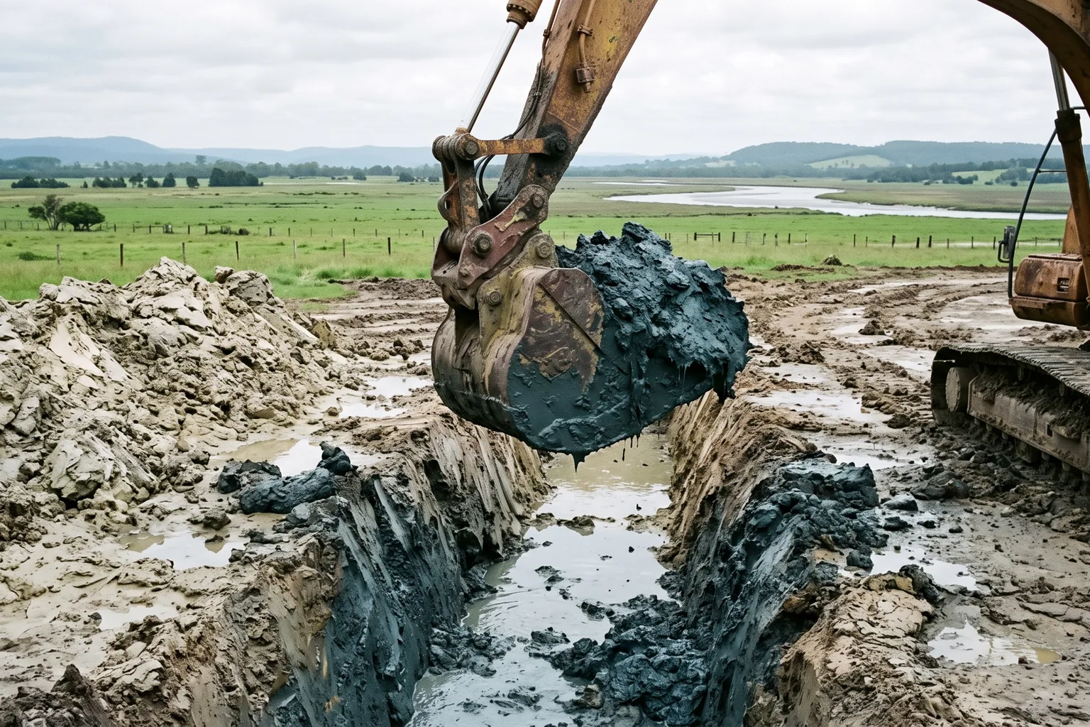
Owners read the acid sulfate soils class on their LEP map as a severity rating and get it exactly backwards. Class 1 is not five times worse than Class 5. The number describes how far below the surface the sulfides are likely to sit, which means the constraint isn't your land. It's your excavation depth, your watertable, and on a subdivision, the volume of soil you were always going to move.
Of all the constraints that turn up on a coastal block, this is the one owners most often read backwards.
The call that stuck with me was about a flat two-hectare parcel a few hundred metres back from an estuary. Good site. Sensible layout for a small subdivision, a road in, lots either side, an on-site detention basin at the low corner because the drainage had to go somewhere. The owner rang because his 10.7 certificate had an acid sulfate soils entry on it and his solicitor had flagged it. Class 3. He asked how bad Class 3 was, on the assumption that Class 1 was the disaster and Class 5 was nearly nothing.
That is the wrong axis entirely, and the misunderstanding cost him about seven weeks.
What the classes actually say
Acid sulfate soils are, in the department's words, "natural sediments that contain iron sulfides". Left alone under water they sit there indefinitely and do nothing. Expose them to air, and Environment and Heritage explains what follows: "the iron sulfides they contain react with oxygen to create sulfuric acid", which in turn makes metals including iron and aluminium "more soluble" so they can be "released in toxic amounts". The acid and the released metals damage waterways, kill vegetation, and corrode concrete and steel.
They are not rare and they are not exotic. They occur "in every coastal estuary in New South Wales", affect more than 260,000 hectares, and because of their estuarine origin are "usually found at elevations less than one metre above sea level". There's an inland variety too, along inland waterways, wetlands and drainage channels.
Now the class map. The classes come from the Acid Sulfate Soils Map that sits under your council's LEP, and the department's own dataset description defines them plainly:
- Class 1 — acid sulfate soils "are likely to be found on and below the natural ground surface".
- Class 2 — "likely to be found below the natural ground surface".
- Class 3 — "likely to be found beyond 1 metre below the natural ground surface".
- Class 4 — "likely to be found beyond 2 metres below the natural ground surface".
- Class 5 — soils "are not typically found in Class 5 areas". Class 5 land is land "located within 500 metres on adjacent class 1,2,3 or 4 land".
Read those five lines together and the axis becomes obvious. This is a depth scale, not a hazard scale. The class tells you how deep you can go before you're likely to be in the material. Class 1 land has it at the surface, so anything at all disturbs it. Class 4 land has two metres of clearance above it, which on a project that never digs deeper than a strip footing is close to irrelevant, and on a project with a basement or a deep drainage line is not irrelevant at all.
Class 5 is the one that confuses everybody, because it isn't really a soil class. It's a buffer. Class 5 land is land near the other classes, and what it's concerned with is not what you dig up on your own block but what your works do to the watertable on someone else's.
Two blocks side by side, same class, one proposing a slab-on-ground house and the other proposing a basement and a pump-out pit, are in completely different positions. The map didn't distinguish them. The excavation does.
The LEP clause, and why the number moves
The class map does nothing on its own. The operative control is a clause in your council's local environmental plan, and it works the way most LEP constraint clauses work: development consent is required for the works described in a table, on land shown on the acid sulfate soils map as being of the class specified for those works.
The objective is usually expressed in a single line. Shoalhaven's development control plan puts it as making sure that proposed development "doesn't disturb, expose or drain acid sulfate soils and cause environmental damage", which is a fair summary of what every version of the clause is trying to achieve. Note the three verbs. Disturb, expose, drain. That third one is where owners get caught, and I'll come back to it.
The clause number is not stable across NSW and this trips people up when they're reading advice written for another council. It's clause 7.1 in the Shoalhaven LEP 2014, with the earthworks clause sitting right next to it at 7.2. Other LEPs number it in the 6s. Some older instruments put it somewhere else entirely. Don't take a clause number from an article, including this one. Open your own LEP, or read it off the planning certificate. That points to the sensible first step: your class is on the Planning Portal spatial viewer under the LEP layers, it takes about a minute to check, and it's free.
The trigger is depth and watertable, not the class
Here's the part that cost my caller seven weeks.
He had assumed that Class 3 meant a Class 3 amount of trouble, spread evenly across his project. It doesn't work like that. The clause hangs off works, and works are described by what they do to the ground: works below the natural ground surface at a specified depth, and works by which the watertable is likely to be lowered.
That second limb is the quiet one. You can trigger the clause without ever touching acid sulfate soil, because lowering the watertable exposes sulfides that were previously sitting safely under water. The ASSMAC guidelines list what does it, and the list is longer than most people expect: extraction of groundwater, excavations to or below the watertable, dewatering of dams, quarries, construction sites or landfills, construction of deep drains, dredging, and, in a nice piece of counterintuition, growing trees on previously cleared land.
Look down that list with a subdivision in your head. Deep drains. Dewatering a construction site. An excavated detention basin at the low corner of the block. My caller's basin was the problem, not his lots. It was going into the wettest part of a site that already sat low, it was designed to hold water and therefore to move it, and it did more to his obligations under the clause than the seventeen house pads ever would have.
When a management plan is actually triggered
This is where the process gets specific, and it's worth understanding because there's an exit at the first step that a lot of owners never find.
The document doing the work is the Acid Sulfate Soils Manual published by the Acid Sulfate Soil Management Advisory Committee in August 1998. It's the document LEP clauses point at, it's still the reference councils assess against, and the assessment guidelines volume is published by the EPA and free to read.
The sequence runs in stages, and the stages exist so you can stop early.
You start with a preliminary assessment. Its whole job is to establish the parameters of the proposed works and whether acid sulfate soils are actually present on the site. The guidelines' advice is that when you're proposing works likely to disturb acid sulfate soils or the associated watertable, a preliminary assessment should be undertaken and advice sought from the council as to whether development consent is required. On a good number of sites this is where it ends. Most LEP clauses carry an exemption where a preliminary assessment prepared under the Manual shows a management plan isn't needed, though the wording varies, so read yours.
If the preliminary assessment says the soils are there and your works will reach them, you move to soil sampling and analysis, and then to a single sharp test. The guidelines call it the action criteria, and they're set out in Table 4.4 by soil texture, because the clay content of a soil affects how much acid it can buffer:
- Coarse texture (sands to loamy sands, roughly under 5% clay): 0.03% oxidisable sulfur, or 18 mol H+ per tonne.
- Medium texture (sandy loams to light clays, 5 to 40% clay): 0.06% oxidisable sulfur, or 36 mol H+ per tonne.
- Fine texture (medium to heavy clays and silty clays, over 40% clay): 0.1% oxidisable sulfur, or 62 mol H+ per tonne.
Those figures apply where between 1 and 1,000 tonnes of soil is being disturbed. Above 1,000 tonnes, all three texture categories drop to the coarse-soil number of 0.03%, which is a significant tightening and one that subdivisions hit routinely.
And then the sentence that decides it, from the guidelines themselves:
An Acid Sulfate Soil Management Plan must be prepared in all circumstances when the Action Criteria in Table 4.4 are met or exceeded.
There's no discretion in that and no balancing. The guidelines add that "works in soils that exceed these action criteria must prepare a management plan and obtain development consent", and that where more than 1,000 tonnes is disturbed at or above 0.03% oxidisable sulfur, a detailed management plan is required. The approval authority is expected to assess the adequacy of that plan before approving the application and to require its implementation as a condition of approval. So it's not a report you file. It becomes a condition you have to build to and monitor against.
What it costs you, in the units I can actually source
I'm not going to publish dollar figures. The only priced tables in this area are in a 1998 document quoting 1998 lime prices, which would be worse than useless, and I have no defensible current source for what an assessment or a treatment programme runs to in NSW today.
What I can give you are the physical quantities, because those come straight out of the guidelines and they haven't changed.
Treatment is mostly liming, and the volumes scale the way you'd expect. Disturb 100 tonnes of clay material carrying 1.0% oxidisable sulfur, and the guidelines put the requirement at roughly 4.7 tonnes of fine lime, which they categorise as high treatment. Disturb 1,000 tonnes of the same material and it's about 46.8 tonnes of lime, in the very high category, plus a more detailed management plan. The guidelines' treatment bands are low under 0.1 tonnes of lime, medium from 0.1 to 1, high from 1 to 5, and very high above 5.
Price that however your civil contractor prices it. The point of the numbers is the shape of the curve, not the dollars. This constraint is close to free at small volumes and becomes a genuine line item once you're moving earth by the truckload, which is exactly the transition from building a house to building a subdivision.
There's an earlier and cruder screen in the guidelines that's useful for a five-minute gut check before anyone is engaged. Volume of material to be disturbed: under 1 tonne, 1 to 10, 11 to 50, or over 50. Distance between the acid sulfate soils and your depth of disturbance: more than 2 metres, more than 1 metre, half a metre to a metre, or nil. Run your own project against those two rows and within a minute you'll know whether this is a conversation or a project.
The geotechnical sting nobody mentions
Now the part that surprised me most when I went back through the guidelines, because it has nothing to do with chemistry.
Potential acid sulfate soil clays are frequently unripe, waterlogged material. The guidelines describe some of them as having "the consistency of a gel with up to 80% water content and hence low bearing capacity", with "considerable lateral movement or subsidence" expected under load.
That is a foundation problem, a road problem and a fill problem, and it applies to extensive landfilling, roads, bridges, dams and major buildings. The guidance is to analyse geotechnical data for the extent of possible movement under load, and to consider preloading the site. There's a detail in there worth carrying to your engineer: material used for preload should itself be non-acid-sulfate, and if it's going to be removed later it should be separated with geotextile so it can come off without contamination.
On a subdivision this matters more than the liming does. Road pavements and services trenches on soft estuarine clay are expensive in a way that has nothing to do with acid, and preloading takes time you have to programme in rather than absorb. If your site is low, flat, near an estuary and mapped for acid sulfate soils, the geotechnical investigation and the acid sulfate assessment want to happen in the same visit, because they're looking at the same material for different reasons.
Where it stacks with everything else
Acid sulfate soils rarely arrive alone, because the ground that carries them is the ground that carries several other constraints.
Low, flat, estuarine land is the same land that turns up on flood mapping, so a block with an acid sulfate class very often also sits in a flood planning area or between it and the probable maximum flood, which is a separate assessment on a separate map with its own set of tests. The two interact in a practical way: flood design tends to want detention and drainage, and drainage is what triggers the acid sulfate clause.
Sydney Water lists acid sulfate soils among the poor soil conditions in which it will not permit building over or adjacent to its assets. If there's a main through your site, that constraint and this one compound, and the build-over rules are decided by the water authority rather than by your council.
And if the block has imported fill of unknown origin, you have two soil investigations to run rather than one, because the acid sulfate question and the contamination question are separate regimes with separate triggers that happen to be answered by the same drill rig on the same day. Bundling them is the cheapest thing you'll do all project.
What I'd do first
Check the class on the spatial viewer before anything else, because it costs a minute and on a Class 4 site with shallow works it may end the enquiry.
If you're in a mapped class, work out your deepest point of disturbance before you fall in love with a layout. Not the house pads. The deepest thing: the detention basin, the sewer connection, the driveway cut, the pump well. That single number, measured against the depth in your class, tells you most of what you need to know.
Then ask the question about the watertable separately, because it's the limb that catches people who never intended to excavate at all.
And if you're subdividing, get the preliminary assessment done in the same week as the geotechnical work and before the surveyor sets a lot layout, not after. Layout-then-assess is the expensive order here for exactly the same reason it's the expensive order on bushfire: the assessment can move the layout, and redrawing a plan of subdivision twice is a cost nobody budgets for.
Questions worth asking before you draw anything
Does an acid sulfate soils class make my land unbuildable?
Almost never. The class describes a depth at which sulfides are likely to be present, not a prohibition, and a very large amount of NSW coastal housing sits on mapped land and was built without incident. What the class does is add an assessment step and, where the action criteria are met, a management plan that becomes a condition of your consent. The projects that genuinely struggle are the ones with deep excavation, significant dewatering, or large earthwork volumes on soft estuarine clay, and even most of those proceed with a plan attached.
Will the acid sulfate soils entry show up on a planning certificate?
The class comes off the acid sulfate soils map that sits under the LEP, and councils commonly report it on the certificate, which is how most owners find out it exists. What a certificate entry does not tell you is anything about your project. It reports the mapped status of the land, not whether your particular works trigger the clause, which depends on your depths and your effect on the watertable. Read it as the start of a question rather than an answer, in the same way as everything else on a 10.7.
Can I avoid the whole thing by not digging?
Sometimes, and it's a legitimate design strategy rather than a dodge. The clause is triggered by works at a given depth and by works likely to lower the watertable, so raising a building on fill rather than cutting into the site, using shallow footings, and keeping stormwater management at or above natural surface can all keep a project above the trigger. Whether that's cheaper than assessing and treating depends on how much fill you need and what the flood levels demand, which is a feasibility question rather than a planning one. It is worth putting to a designer early, because it's a decision that has to be made before drawings, not after.
Who prepares an acid sulfate soils management plan?
An environmental or geotechnical consultant with acid sulfate experience, working to the Manual. What you're buying is a document the council will condition into your consent, so the useful question at the quoting stage isn't just the fee but whether the consultant has had plans accepted by your particular council recently. Councils on the north coast and the south coast see these constantly and have firm views about what an adequate plan looks like. A consultant who works in that council area weekly will produce a plan that gets through. One who doesn't may produce a technically fine document that comes back with requests.
Does this affect what a developer will pay for my land?
It affects the discount applied to the unknown more than it affects the actual cost, which is the same pattern that shows up with contamination. A buyer running a feasibility on a mapped site with no assessment prices the tail rather than the median, because they don't know whether they're looking at a modest liming programme or a preload and a nine-month programme extension. A preliminary assessment retires most of that uncertainty for a modest fee, and on a low coastal site it's usually the single highest-return piece of due diligence available before you talk to anybody.
PropertyThrive checks the acid sulfate class, the flood and drainage picture and what they jointly do to a realistic yield as part of a free development assessment, and where a site has a real problem we say so before anyone pays for drawings. Book an assessment and you'll have the read back within 24 hours.
Ready to get started with developing a property?
Get your development assessment or speak with our development experts today
24-Hour Response Guarantee
Submit your details and receive your preliminary development assessment within 24 hours, guaranteed.
No Obligation, Completely Free
Our assessment and initial consultation are completely free with no strings attached. Only proceed if you're 100% happy.
Strategic Development Partnerships
Partner with us to maximise development potential through joint ventures, profit-sharing, or direct acquisition options.